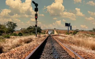
In the realm of railway surveying, embracing the power of technology is paramount. One such technological leap is the integration of Building Information Modelling (BIM) and Geographic Information Systems (GIS). At Softech Rail, we adopt a comprehensive approach by combining BIM and GIS technologies in our wide range of railway surveying services, including Railway Track Survey, Rail Infrastructure Inspection, Track Alignment Measurement, Geospatial Railway Mapping, Rail Surveying Services, Track Maintenance Surveys, Railroad Asset Assessment, Railway Topographic Survey, Surveyors for Rail Projects, and Precision Railway Measurement. In this article, we explore how the integration of BIM and GIS is shaping the future of railway surveying.
Railway Track Survey: BIM for Precision
In Railway Track Survey, BIM technology enhances precision and allows for the detailed mapping of tracks, ensuring accurate data collection and analysis.
Rail Infrastructure Inspection: GIS for Spatial Insights
Rail Infrastructure Inspection benefits from GIS by providing spatial insights, allowing us to analyse infrastructure from a geographical perspective and identify potential issues.
Track Alignment Measurement: BIM-GIS Synchronization
The synchronization of BIM and GIS is vital for Track Alignment Measurement. It ensures that alignment data is not only precise but also geographically contextual.
Geospatial Railway Mapping: Combining BIM and GIS
Geospatial Railway Mapping combines the power of BIM and GIS to provide highly detailed maps for efficient rail system development and planning.
Rail Surveying Services: A Holistic Approach
Our Rail Surveying Services take a holistic approach by integrating BIM and GIS across the spectrum. This integration enhances precision, safety, and efficiency in every service.
Track Maintenance Surveys: Predictive Analytics with GIS
GIS enables predictive analytics in Track Maintenance Surveys, helping us detect potential issues before they escalate and ensuring reliable rail operations.
Railroad Asset Assessment: BIM for Comprehensive Data
BIM technology offers comprehensive data for Railroad Asset Assessment, ensuring that assets are thoroughly evaluated, including their geographical context.
Railway Topographic Survey: Detailed Terrain Mapping
For Railway Topographic Survey, the integration of BIM and GIS provides detailed terrain mapping, which is essential for environmentally sensitive planning.
Surveyors for Rail Projects: BIM-GIS Expertise
Our Surveyors for Rail Projects are experts in BIM-GIS integration. They leverage these technologies to provide accurate and comprehensive data for rail projects.
Precision Railway Measurement: Efficiency through Integration
Precision Railway Measurement relies on the efficiency of BIM-GIS integration. It enhances the accuracy of rail system data, leading to cost savings and safety enhancements.
The integration of BIM and GIS technologies is transforming railway surveying. At Softech Rail, we are committed to delivering precision, safety, and efficiency in our railway surveying services, including Railway Track Survey, Rail Infrastructure Inspection, Track Alignment Measurement, Geospatial Railway Mapping, Rail Surveying Services, Track Maintenance Surveys, Railroad Asset Assessment, Railway Topographic Survey, Surveyors for Rail Projects, and Precision Railway Measurement. Contact us to discover how this comprehensive approach can elevate your railway surveying practices and shape the future of rail systems.